By
By PAGASA LPA Forecast
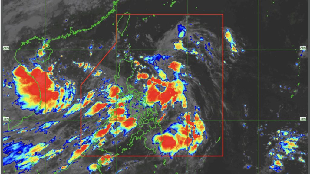
The Philippine Atmospheric, Geophysical and Astronomical Services Administration (PAGASA) announced on Wednesday that it is closely monitoring cloud clusters east of the country which may potentially develop into a low-pressure area (LPA) within the next 48 hours.
According to PAGASA, the cloud formation is currently located over the Philippine Sea and is showing signs of gradual consolidation. If it continues to intensify, it could form into an LPA, which may influence local weather patterns in the coming days.
“We are monitoring the cloud cluster, and it has a high chance of becoming an LPA within two days,” PAGASA forecaster Benison Estareja said in a morning bulletin.
Tropical Depression Outside PAR Also Monitored
In addition to the potential LPA, PAGASA is also observing a tropical depression located outside the Philippine Area of Responsibility (PAR). The system was spotted more than 600 kilometers west of Zambales, and while it remains outside the country’s boundary, forecasters are tracking its movement and possible indirect effects.
At present, no direct impacts on Philippine landmass have been reported, but PAGASA advises the public to remain vigilant and regularly monitor updates.
Public Advisory
Though the cloud cluster has not yet developed into a weather disturbance, localized thunderstorms, occasional rain showers, or gusty winds may be experienced, particularly in eastern sections of Luzon and Visayas. Fisherfolk and coastal communities are also advised to take precautionary measures, especially if sea conditions worsen.
PAGASA will issue official updates should the system evolve into a low-pressure area or tropical cyclone.